
Flood Modeling + Automation
A model that is difficult to update becomes a snapshot. These workflows are built for repeated runs as scenarios, terrain, and questions change.
-
HEC-RAS + Flood Modeling
Rain-on-mesh 2D models built from LiDAR, breaklines and hydraulic structures, run across the whole surface rather than down the studied channels. Watershed and city scale, across multiple storms, alternatives and future conditions.
-
GIS + Web Maps
Interactive maps and dashboards that turn model results into something staff, decision-makers and residents can actually use.
-
Benefit-Cost + Mitigation
Structures, population, depth and finished-floor exposure, then the damages, benefits and the BCR a federal reviewer expects to find under a project.
-
Grants + Funding
Turning the analysis into priorities, mitigation projects and applications a program will actually pay.
Modeling Automation
Python, APIs and open-source tools for automating HEC-RAS, GIS and repetitive analysis. Training included, so a team can maintain the workflows itself.
Build the model once. Use it many ways.
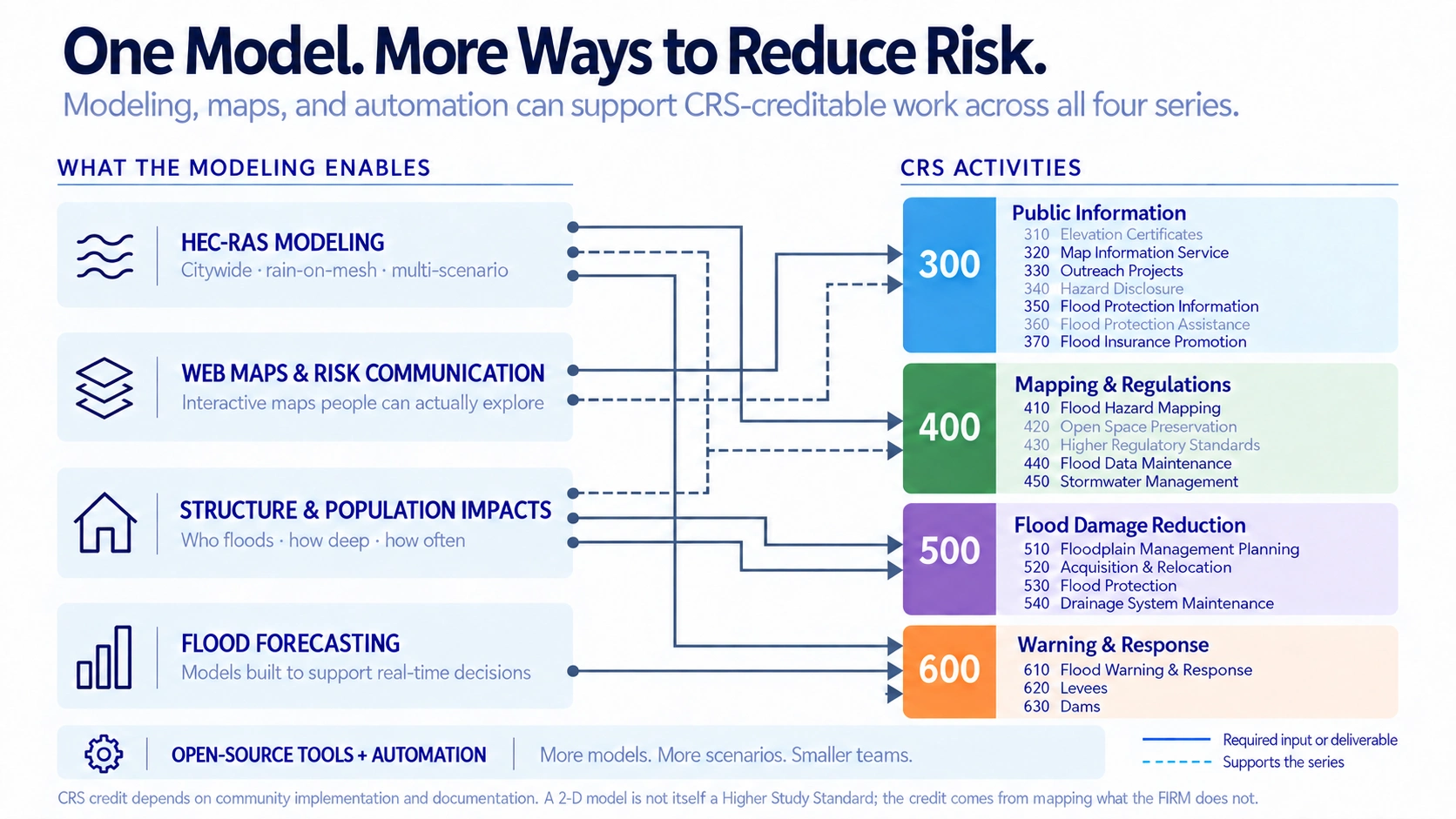
Under the Community Rating System, a community that documents this work earns a better class, and its NFIP policyholders pay less for flood insurance. Most communities are already doing much of the work. One model supports it across all four activity series.
From flood depth to a funding case
Funding applications need more than a project list. They need a defensible estimate of who benefits and how much damage the project avoids.
- Identify who benefits. Assign modeled flood depths and damages to the buildings a project would protect.
- Test the project. Compare existing and proposed conditions to measure the flooding and damage it prevents.
- Know before you apply. Determine whether the benefits justify the cost before spending a grant cycle finding out.
Start with a conversation
Happy to look at your watershed and say whether a model would show you anything you do not already know.